After going through the coldest December since 2000 in the Twin Cities, we thought the worst of it was over, right? Nope. The more things change (a new year), the more they stay the same. As you may have already heard, some of the coldest air in two decades will make it’s way to the Upper Midwest on Sunday and Monday. The Governor of Minnesota has already closed schools for the day across the state.
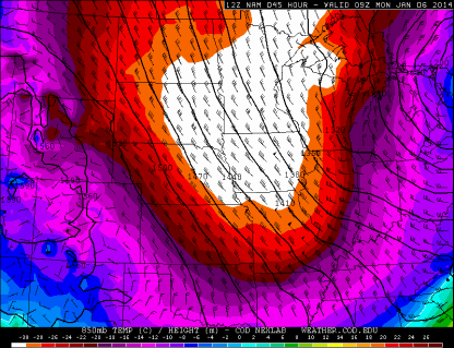
The 850 millibar maps early Monday morning show this surge of artic air from the polar region.
A closer look at 5,000 feet above sea level, shows the temperature of this cold pool of air approaching –30 degrees Celsius, which translates to –22 degrees Fahrenheit.
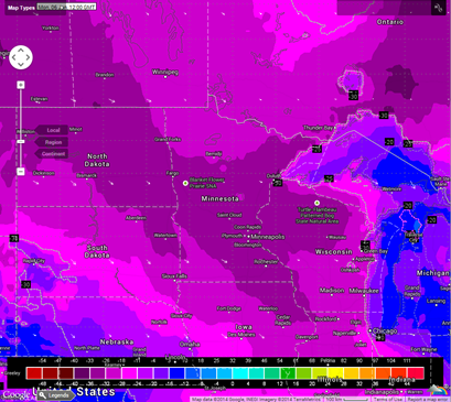
The European forecast model, which is my favorite in terms of accuracy, shows actual air temperatures anywhere from –20 to –30F to start the day Monday.
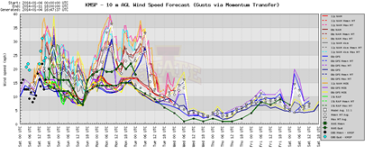
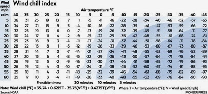
Now you throw in the wind, which will be sustained around 15 mph, with higher gusts throughout the morning, and we’re talking wind chill readings below –40F in the Twin Cities. For that reason, a Wind Chill Warning has been issued for the entire state of Minnesota from Sunday night through mid-day Tuesday. We may even see some parts of the state approaching the –60F mark at times, particularly across northern Minnesota.
Have we been spoiled by mid winters over the last 10-15 years? Perhaps. However, these kind of conditions are dangerous, and being outside should be avoided, period. 10 minutes is all it takes to receive frostbite, with effects that could be long-term if untreated immediately.
RS


