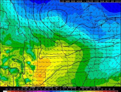
The first snowfall of the season occurred during the morning hours of Sunday as a cold pool of arctic air dipped into the state, hovering primarily north of Interstate 94. Upper air temps at 850 millibars were at or below zero Celsius, with a low pressure area near the Minnesota/Dakotas border.
By the mid-morning Sunday, the heaviest snow was located over central Minnesota. St. Cloud was one of the locations affected.

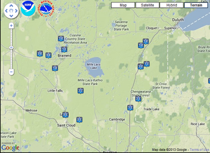
As you might suspect, this is the area where the accumulating snow fell. From the Brainerd Lakes area to the St. Croix River is where the snow band setup, in the vicinity of the low pressure area.
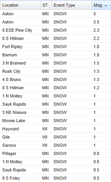
Askov was the Golden Shovel winner, coming in at five inches of snow. One to three inches of snow was common elsewhere in central Minnesota.
The Twin Cities did not receive any official snow, but it certainly was a close call. Had the low pressure area tracked further south, MSP would have been in line to see accumulating snows. The last snow accumulation in the Twin Cities this year was a half inch on May 3, just one day after the infamous late season “Mayday” storm that impacted southeast Minnesota and western Wisconsin. I do not think we will be able to dodge too many more bullets. Whether we want to see it or not, snow will be here soon!
RS


