Severe weather returns to Minnesota after late June wind storms caused $17.8 million dollars worth of damage, and Xcel Energy called it the most significant power outage in the state’s history.
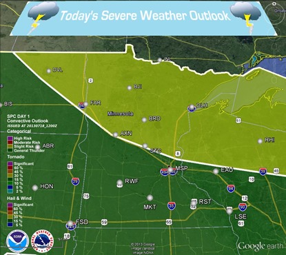
Storms today will be mainly confined to the Northland, and Arrowhead regions of the state where a stalled frontal boundary is draped across the international border.
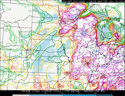
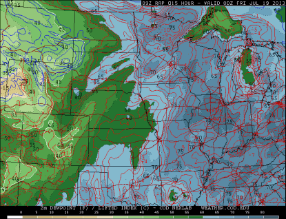
With temperatures well into the 90s across much of the state, and with dew points at or above 70 through the afternoon, there will be more than enough energy, or juice to initiate storms by the evening.
Tropical air and lifted indices approaching -10°C on the RAP model will more than support thunderstorms, and possibly super cells.
I believe storms will form over north central Minnesota, and then move east-southeast during the evening. Supercells will eventually build into a linear MCS as the day progresses.
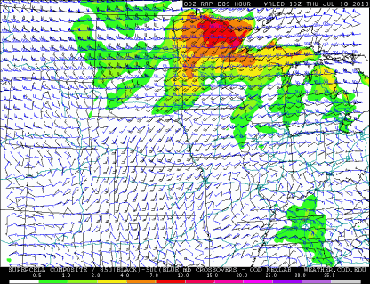
The primary severe weather threats are wind and large hail. Winds will be out of the west at 500 mb, and at the southwest 850 mb. Had the winds been more southeast at 850 mb, I believe there would be a heightened risk of tornadoes. Powerful winds, as we saw in the Twin Cities, can cause low-end tornado-like damage.
Persons camping in the Boundary Waters Canoe Area and along the North Shore will definitely need to keep an eye to the sky today. Unfortunately, these areas are isolated, and having means of receiving weather information can be difficult. This is why I always pack a weather radio that can run off AC power, batteries, and even hand cranking, as a last option. These storms will mean business today, and being caught outside far from shelter is a worst case scenario. Stay tuned for additional updates on Twitter and Facebook today!
RS


