Showing posts with label minnesota. Show all posts

Sunday, January 2, 2011

Top 5 Minnesota weather events of 2010

Welcome to 2011. 2010 is now in the books and was a crazy year for weather that Minnesotans experienced. From the snowless March, spring and fall flooding, record number of tornadoes, biggest outbreak of tornadoes in one day, record low pressure readings that brought destructive winds, the greatest winter storm to hit the Twin Cities and surrounding areas since the Halloween Blizzard of 1991, to the snowiest December on record. In reflection on 2010, here are my top 5 weather events for 2010. The top events as voted on by weather enthusiasts are here.

#5 Heavy rainfall on September 22-23, 2010

Waves of heavy rain moved across the southern portion of Minnesota over a two day period on September 22 and 23, triggering instant flash flooding. The highest total rainfall total received in the area was 11.06 inches from an observer in Faribault County, with many areas picking up 8+ inches. Paul Huttner said, “Some central Minnesota [towns] got a summer’s worth of rainfall in one day.” This rain ran off into the Minnesota River, which then flowed upstream into the Mississippi River. Many areas experienced near or record high water levels with this unusually fall flooding event.

ff100922-23

Here is video I captured of the Minnesota River flooding as it happened in Shakopee on October 2, 2010.

Locally, this was the seventh highest river crest in Shakopee, reaching 716.5 feet, causing the highway 101 river crossing in Shakopee and highway 41 in Chaska to be closed for a couple weeks until the river receded back into it’s banks.

#4 Record Low Pressure on October 26-27, 2010

On Monday, October 26th, an intense area of low pressure moved from the plains through Minnesota. The low developed in response to powerful jet stream winds from the west, and a major contrast in temperatures – warm, moist air to the south and cold air to the south . At 5:13 pm on Tuesday, October 27, 955.2 millibars (28.21 inches of mercury) was observed at Bigfork, Minnesota, located in the north central part of the state. Powerful winds occurred Tuesday as the low tracked in a south to north direction. Sustained winds of 30 to 45 mph with gusts of 50 to 65 mph were common. Tree branches were knocked down resulting in sporadic power outages. This put those without power in a dangerous situation as artic air moved in with no heat available. Fortunately, utility crews were able to restore power within a day.

sfclowanimation_gif
Graphic courtesy National Weather Service - Chanhassen

#3 The Great Blizzard of 2010 on December 10-11, 2010

10Dec11_18Zsfcmap

The largest snowfall in almost 20 years for the Twin Cities fell over the days of December 10 and 11. When the snow ended, it would be the largest snowstorm to affect the Twin Cities in December, and the fifth largest snowfall from any one storm on record. Strong winds associated with this storm created blizzard-like conditions across southern Minnesota and the southern parts of the Twin Cities metro, which reduced visibilities to one-quarter mile or less. This resulted in MSP airport being shut down for four hours. 17.1 inches of snow fell at the airport over the two days, and locally, I measured 21.5 inches of snow on the front sidewalk. To the east in Eau Claire, Wisconsin, the city picked up 22 inches of snow in one day, setting a new record.

Dec11_SnowMap4

The weight of all the snow collapsed the roof of the Metrodome in Minneapolis, MN. This was the fifth time the roof has been deflated since it was built in 1981, and fourth time due to heavy snow. Significant damage was done to the roof panels, and it is reported it will take until at least March to make the stadium operable again. Fox Network had cameras in place inside of the Dome and captured the remarkable roof collapse shown below.

#2 104 Tornadoes for 2010

Minnesota saw the greatest number of tornadoes in one year during 2010 with 104 counted by the weather service offices - 71 of these occurring in the month of June. The red dots in the map below are locations where initial tornado reports were made during June. There are two distinct “tornado alleys”, the first over southern third of Minnesota and a second area over northwest Minnesota, north of the the Fargo, ND/Moorhead, MN area.

MN_statemapjune

The state shattered the previous annual record of 74, set in 2001. From 1950 to 2010, Minnesota averages 27 tornadoes a year, so the state saw 4 times as many tornadoes in a typical year.

#1 48 Tornadoes on June 17, 2010

The top event on my list is the 48 tornadoes that touched down in Minnesota on June 17, 2010.

100617_rpts

This would go down as the largest single day tornado outbreak in Minnesota history. Previously, 27 tornadoes occurred in the state on June 16, 1992. Most people many know that day for the F-5 tornado that struck Chandler, MN. The Storm Prediction Center noted that it could be a potentially dangerous day by highlighting most of Minnesota for a moderate risk of severe weather.

day1otlk_20100617_1200_prt

Forecasters warned that there could be significant tornadoes and that people stay tuned for the latest information.

PUBLIC SEVERE WEATHER OUTLOOK
NWS STORM PREDICTION CENTER NORMAN OK
1131 AM CDT THU JUN 17 2010

...SIGNIFICANT SEVERE THUNDERSTORMS EXPECTED OVER THE UPPER MISSISSIPPI VALLEY INTO PARTS OF THE MID MISSOURI VALLEY TODAY AND TONIGHT...

THE NWS STORM PREDICTION CENTER IN NORMAN OK IS FORECASTING THE DEVELOPMENT OF LARGE HAIL...DAMAGING WINDS AND A FEW TORNADOES OVER THE UPPER MISSISSIPPI VALLEY INTO PARTS OF THE MID MISSOURI VALLEY TODAY AND TONIGHT.

THE AREAS MOST LIKELY TO EXPERIENCE THIS ACTIVITY INCLUDE

MUCH OF IOWA
MUCH OF CENTRAL AND SOUTHERN MINNESOTA
FAR EASTERN NEBRASKA
FAR EASTERN SOUTH DAKOTA
FAR WEST-CENTRAL WISCONSIN

ELSEWHERE...SEVERE STORMS ARE ALSO POSSIBLE ACROSS THE NORTHERN PLAINS AND UPPER GREAT LAKES.

A POWERFUL UPPER-LEVEL STORM SYSTEM WILL MOVE EASTWARD TODAY ACROSS THE NORTHERN PLAINS...WHILE AN ASSOCIATED SURFACE LOW PRESSURE CENTER AND TRAILING COLD FRONT SHIFT EWD ACROSS THE DAKOTAS AND NEBRASKA INTO MINNESOTA AND IOWA. A WARM AND HUMID AIR MASS PRESENT AHEAD OF THIS STORM SYSTEM WILL FUEL SEVERE THUNDERSTORM DEVELOPMENT THIS AFTERNOON ALONG THE COLD FRONT INITIALLY OVER THE EASTERN DAKOTAS AND EASTERN NEBRASKA...WITH STORMS SUBSEQUENTLY DEVELOPING EAST INTO MINNESOTA...IOWA AND WISCONSIN THROUGH TONIGHT.

THE WARM/HUMID CONDITIONS IN CONJUNCTION WITH STRONG JET STREAM WINDS WILL FAVOR THE DEVELOPMENT OF INTENSE...SEVERE STORMS INCLUDING SUPERCELLS WITH THE THREAT FOR LARGE HAIL...A FEW TORNADOES --POSSIBLY STRONG-- AND DAMAGING WINDS. WITH TIME...STORMS MAY ORGANIZE INTO A LARGE COMPLEX WITH THE POTENTIAL FOR MORE WIDESPREAD DAMAGING WINDS SPREADING EAST ACROSS PARTS OF MINNESOTA AND IOWA INTO WESTERN WISCONSIN TONIGHT.

STATE AND LOCAL EMERGENCY MANAGERS ARE MONITORING THIS DEVELOPING SITUATION. THOSE IN THE THREATENED AREA ARE URGED TO REVIEW SEVERE WEATHER SAFETY RULES AND TO LISTEN TO RADIO...TELEVISION...AND NOAA WEATHER RADIO FOR POSSIBLE WATCHES...WARNINGS...AND STATEMENTS LATER TODAY.

Three EF-4 tornadoes touched down that day. Two in Otter Tail County, and one on Freeborn County. Three persons died, and there were 45 injuries reported.

image

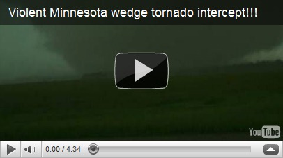
One of the most devastated areas from these strong tornadoes was the town of Wadena, MN. Many homes were destroyed as well as the high school and stadium. Storm chaser video by Reed Timmer of the Wadena tornado, shot below.
2010 was a very active and memorable year as far as weather goes in Minnesota. How will 2011 turn out? We will eventually find out, but the record amounts of snow in December has me concerned about major spring time flooding. Forecasters are already concerned along the Red River for the potential of significant spring flooding. This blog will have you covered in 2011 for all things weather! I would also like to take this time to thank all my loyal readers who stopped by in 2010. It’s nice to know there is an audience for this kind of information and that it serves a helpful, useful purpose. If you know someone who might be interested in reading what I have to say, please pass on this blog’s link to them. All are welcome! Here’s to 2011. Cheers!

RS

Wednesday, July 21, 2010

7/17/10 Chase: MN

On Saturday, July 17, 2010, severe storms ripped through the central part of Minnesota with hail, strong winds, and a few reports of tornadoes. Severe weather was anticipated this day as the Storm Prediction Center (SPC) had placed much of the southern half of Minnesota under a moderate risk of severe storms as early as Friday.

day1otlk_20100717_1200_prt The early Saturday AM outlook from the SPC with the moderate (MDT) risk of severe storms outlined in red.

My initial chase target late Friday night/early Saturday morning was Benson, MN based on what the 4.0km WRF model was telling me. Storms started firing around the Alexandria and St. Cloud areas along I-94, north of a warm front, after the noon hour. It was a little surprising to see storms firing so early in the day and the proximity to the Twin Cities. That caught me off-guard a little bit with the differences in what the model data was telling me. This activity was east of what I felt were the greatest dynamics for tornadoes, so I asked myself how this could be happening. Going into Saturday morning, I expected to see storm development just east of the MN/ND/SD border sometime after 2 PM local time with movement to the east-southeast. Scraping my plans to head west, I began my trek up towards I-94 towards St. Cloud. Not long into my journey, a tornado watch was issued at around 12:30 PM until 8 PM, which included most of central MN. The watch got as close to the Cities as Wright Co., but a few of the immediate Twin Cities metro counties were added later as the watch boundaries were extended.

ww0483_radar

As I travelled towards the Albertville area on I-94, I started loosing confidence in this cell north and west of St. Cloud as it began to get so massive. Still north of I-94, this cell appeared to evolving into a heavy rain and hail producer with a funnel cloud report mixed in near Gull Lake around 12:45 PM. I’m not one who likes to sit underneath or punch into cores containing large hail. It damages your vehicle unnecessarily and jeopardizes my safety with the possibility of windows breaking and being injured by broken glass. Just don’t understand it, but that’s my prerogative, just as it is for those who drive or sit idle through it. How to chase is up to each individual. Digressing from that tangent - since these cells were outside of what I felt was the greatest dynamics for the possibility of a tornado, I decided to leave this cell and head back south and take US-12 out west to intercept some storms heading for Willmar. Based on CAPE values and wind shear, I took a gamble that these storms would intensify rapidly and possibly produce a tornado.

I caught up with some storms in Wright Co that I followed for an hour west to east from Cokato to near Buffalo before they died out. The storms near St. Cloud were still maintaining their intensity, so I decided to head north on Hwy 25 in Buffalo to check it out.

1%20a%20a%20wunder2-thumb-500x325[1] Cells near the I-94 corridor just before 2 PM producing large hail and heavy rains. (Image credit: Paul Huttner)

Around 2:30 PM, the St. Cloud storm was beginning to move south of I-94 and move in a southeasterly direction towards the Twin Cities as it picked up speed along the warm front that was slowly sagging to the south.

1%20a%20a%20tor%20osakis Storm cell at 2:39 PM with a hook near Sauk Centre on I-94. At this point, this cell would carry tornadic characteristics as it marched towards the Cities. (Image credit: Paul Huttner)

Made the decision to stay east of the cell and attempted to stay in front of it taking the State Highway 15 south exit on I-94 around 3:35-3:40 PM. The cell was tornado warned at 3:28 PM and heading in my direction. Greatest area of concern was around Eden Valley and Watkins. Attempting to cross in front of the cell so I could get in position on the backside of the cell before being dumped on with heavy rains in hail, I arrived near Kimball, MN around 3:45 PM.

pauldouglas_1279400372_radar10 Radar velocity scan of an area of rotation approaching the towns of Kimball and Kingston Township at about 3:45 PM. (Image credit: Paul Douglas)

103 104 105 106

Above are pictures taken from 3:44 to 3:46 PM from my phone inside the car near Kimball, MN looking north and west. It was a very mature supercell with strong updrafts and one report of 4.25” inch hail as it came through Sauk Center at 3:37 PM. Not a storm to be stuck standing in front of you.

1%20a%20a%20tor%20ann2Radar image at 4:16 PM when a tornado was reported southeast of Kingston Township (Image credit: Paul Huttner).

About a half hour later, I continued trekking south on Highway 15 through heavy rains, winds, and some pea to dime size hail as the activity moved through Kimball towards Kingston Township. Wanting to get out of the rain and get some photo opportunities I turned off onto a county road west of Kingston to spend some time with the Nikon camera.

001 002 003 004006

These pictures were taken looking east from my position, which was just southwest of Kingston. As I began shooting pictures around 4:15 PM, a tornado was reported 2 miles southeast of town just a minute later. I could not locate the tornado from my position, but there definitely were a lot of low hanging clouds. In this high precipitation supercell, it was tough to get a clean look at much of anything this day. A local passed me by as I was taking pictures, and asked if I was a storm chaser and wanted to know what specifically is a wall cloud. I tried to explain to the best of my abilities without having a visual to show him and also not boring him with technical jargon. It’s nice to run into people that take an appreciation of the weather and want to learn more about it. Although I didn’t recommend it at the time, hopefully this person takes enough interest to sign up for a Skywarn class. The system could definitely use all the trained eyes it can get. Meeker County gets a fair amount of storms each year, so each individual provides a great service to it’s community.

Leaving the Kingston area, I continued following the west side of this cell as it moved through Meeker, Wright, and Carver Counties through the 4 and 5 PM hour. Made another stop for pictures at 4:55 PM in far northeastern McLeod County, a couple miles north of Winsted, MN. Incidentally, an EF-0 tornado touched down in this vicinity back on June 17th.

008 009 011

Photos from north of Winsted, MN looking east towards Watertown, MN (8 miles away). Two minutes after stopping, at 4:57 PM, spotters reported a tornado 3 miles west of Watertown. Again, I could not see this tornado from my vantage point. From what I could tell, the lowering to the right was merely scud as it appeared to be disconnected from the thunderstorm base. Can’t really speculate as to whether this was being reported as a tornado or not. Watching this for a few minutes, I didn’t see anything worthwhile to stick around for, so I hopped back into the car and met up with State Highway 7 south of Winsted.

012014015

Some more pictures taken along Highway 7 as the storm bared down on Waconia, Victoria, Chanhassen, and Chaska. The supercell started to really fall apart east of Mound and no longer posed much of a tornado threat by 5:45 PM. This is where I called off the chase.

Finally, I will leave you with some chase video I shot from my dash cam along Hwy 7 as seen streamed live on Severe Studios. Notice how many locals were out watching the storm. Overall, people handled themselves really well. Cars were parked on the side of the road and traffic was kept moving, albeit slow, since everyone was watching the sky, which I can understand. It sure beats hearing stories of chasers passing cars at 100 MPH and passing up inclines with an obstructed view of traffic heading towards them. Enjoy the video!

Miles: Approximately 350
Reports submitted: 0

RS

Saturday, March 20, 2010

Flood video of Minnesota River near Jordan, MN


Moving water from the Minnesota River over Carver County Road 11, 2 miles NNW of Jordan, MN.

Friday, March 19, 2010

2010 Flood pictures

Pictures taken Friday, March 19th of flooding conditions along the Minnesota River in Shakopee and Jordan.

West of County Road 101 and south of the Minnesota River in Shakopee. The river is well out of it's banks. Highway crews were shutting down the 101 river crossing as I was taking these pictures.


Pictures taken 2 miles NNW of Jordan near the Minnesota Valley State Recreation Area (map of general area below):


Sunday, March 14, 2010

TGIS! (Thank God It's Spring)

What an absolute treat we had for weather on Sunday. No forecast model even came close to predicting a 60 degree day, let alone 50 degrees. However, I don't think many people will be complaining about this miscalculation. The Twin Cities official high temp of 64° as well as Eau Claire, Wisconsin's high of 66° were record-breaking. It was a morale-boosting day as many people took advantage of getting outside and soaking it all in. A walk, followed by cleaning out the gunk on the garage floor that had accumulated all winter was on my agenda. The foot of snow we had at the beginning of March is all but gone. All that's left are a few small snow piles on areas that don't see much sunlight or are tucked away in low-lying areas. The Twin Cities metro area saw roughly an inch of snow melt per day from March 1 to March 12.

This unexpected warmth has triggered an accelerated snow melt and revised flood forecasts from the National Weather Service. Many river towns/cites around the Twin Cities are going to see minor to moderate flooding. Ice jamming is going to be a common occurrence this spring. As of Sunday night, an ice jam was reported along the Minnesota River near Henderson that triggered a flash flood warning for the overnight hours.
AT 716 PM CDT...EMERGENCY MANAGEMENT REPORTED AN ICE JAM ON THE
MINNESOTA RIVER APPROXIMATELY A HALF MILE TO A MILE DOWNSTREAM
FROM THE TOWN OF HENDERSON. AREAS NEAR STATE HIGHWAY 19 INCLUDING
SIBLEY COUNTY HIGHWAY 6 LEADING NORTH OUT OF HENDERSON AND STATE
HIGHWAY 93 SOUTH OF HENDERSON MAY BE AFFECTED BY FLOODING DUE TO
THIS ICE JAM. RESIDENTS LIVING ALONG THESE ROADS SHOULD PAY CLOSE
ATTENTION FOR CHANGES IN THE RIVER LEVELS.


Red River Update. For Fargo, North Dakota residents, the Red River is expected to reach a level on Friday night of 38 feet, which would make it the forth largest crest on record if the numbers hold. The river will continue to fluctuate around this level during the upcoming weeks, so I am concerned that the river could rise to 40 feet when it's all said and done.


This week's outlook. Dry weather and at or above average temps will continue into this week with rain chances coming Tuesday (20%) as a disturbance moves through and Thursday night (30%) when a cold front moves through the state. As the GFS model above indicates, we may be starting our weekend on a soggy note as Saturday could bring us a good chance of a rain/snow mix. We are very close to the rain/snow line, represented by the pink line. As we get closer to Saturday, the forecast models will become more defined. Any precip will not help out with flooding. .75 or 1 inch of rain could prove to be disasterous for residents along rivers. Let's hope we don't see much rain for a while!

Friday, March 5, 2010

Red River flooding and weekend update

Well, what a beautiful week it was! A nice, sunny stretch of temperatures around 40 degrees. Just warm enough to crack open a car window to get some fresh air, or take advantage of a peaceful walk. As you have seen from looking outside, we have lost much of our snow pack. Snow lovers fret as they are now on borrowed time to get the most out of their winter activities. Dare we see some patches of dormant grass already? If not for the snow, we may have seen temperatures 10 or 15 degrees warmer this week and borderline shorts weather! Much of the sun energy this time of the year is used to melt the lowest layers of the snow.


It has been very dry month of February across Minnesota with most places seeing less than an inch of precipitation. This has aided in the decrease of widespread flooding concerns across the state.


Change in the air? It looks like our streak of dry days are about to come to an end. The GFS forecast model above is showing some rain moving into the area for Saturday. The pink line, called the "540 line" in the meteorological world, is the rain/snow line. We will stay in the warm sector, so the precip will fall as rain. Some of the roads may become slick as temps will fall below freezing as the sun sets Saturday. Take it easy out there if you must drive. Sunday looks like the better day of the two as the rain moves out of the area and sunshine returns.

The updated spring flooding outlook came out for south central Minnesota and eastern North Dakota from the North Central River Forecast Center. With the lack of precipitation over the last month, the probabilities of major flooding along the Minnesota and Mississippi rivers are low. The exception here is the Mississippi River at Hastings - there's about a 70% chance of the river reaching a flood stage of 18 feet.


That's the good news, now the bad news. Our friends that live along the Red River are still likely to experience severe flooding due significant rainfalls last fall and a greater, and heavier snow pack this winter. The city of Fargo will likely receive the brunt of the flooding as flooding will be imminent within 90 days. There's a greater than 98% chance the the river will crest to major levels at 30 feet. Last week, Fargo Mayor Dennis Walaker declared a state of emergency for the city. Citizens should already begin preparations for sandbagging and moving valuables to higher ground. If there is any positive news, the river in Fargo does not appear to reach the 2009 level of 40.84 feet. Only a 30% chance of this happening.


Next week's outlook: The weather pattern becomes more active as we will see rain chances increase Tuesday and into the middle of the week. Temperatures in the mid-40s throughout the week.