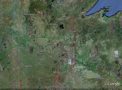
Repeat performance? Another day of active weather is possible for Minnesota as there is a slight risk of severe storms south of a Alexandria, Milaca, to Stillwater, MN line. Not expecting tornadoes today, as was the case yesterday southwest of Fergus Falls, and any severe weather that does occur will be isolated. Damaging winds will be the primary threat.
Yesterday’s storm reports. Here is a graphical depiction of the storm reports received from Saturday’s storms. As supercells developed on the Minnesota/Wisconsin border, they had enough spin in the atmosphere to produce tornadoes before moving east-southeast along a frontal boundary draped across Interstate 94 towards St. Cloud and the Twin Cities and dropping fair amounts of rain across the area.
Awesome video. Here’s video of a tornado shot by Andy Gabrielson of SevereStudios near the towns of Doran and Campbell in Wilkin County, located in northwest Minnesota. This guy always seems to be at the right place at the right time, and has captured some amazing footage this year. My hats off to him.
RS

![lsr08072010[1] lsr08072010[1]](https://blogger.googleusercontent.com/img/b/R29vZ2xl/AVvXsEjMvkO9mRs59h1v9iwrmaCWTsAh8wEsrkCpD-3u6Let5A0bAIBN12AvJ-wAs6KGYxGidtN60IFaY-AX6QcDmpPaDSoPJw3JxkZT1IqyGLWgp_Z5WfmekK5-78sZnqnk5bUyAZRa0V7Pq0A/?imgmax=800)

No comments:
Post a Comment